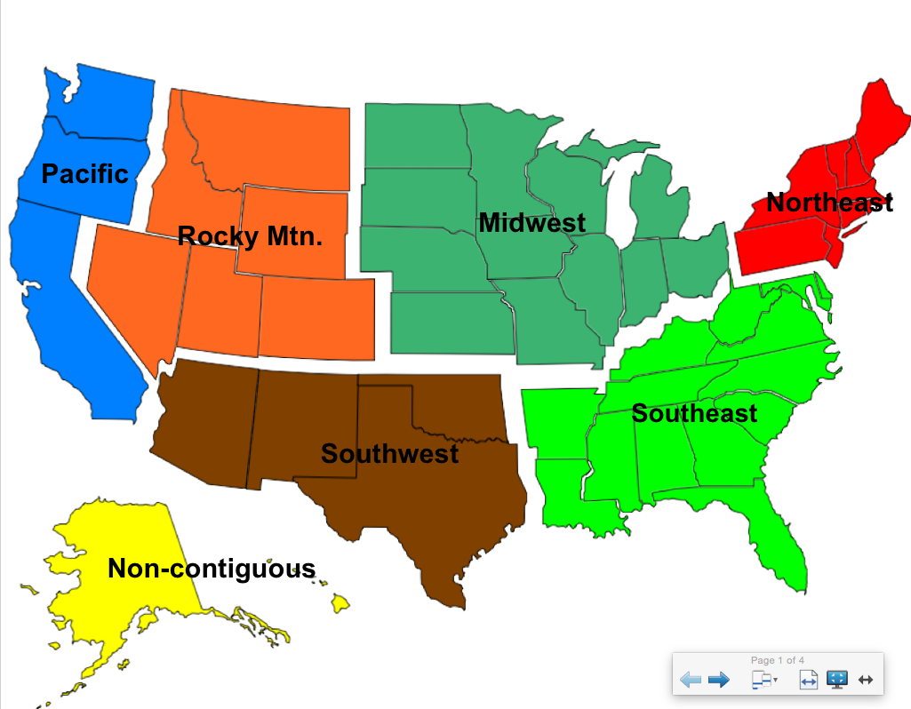
This week I had the assignment of creating a lesson for Smart board using Smart notebook. Well this was the first time I have ever had to create anything for use on a Smart board, and trust me I was very confused with the task at hand. I had no idea on what type of lesson to create or how to use the software. I decided that since I want to be an elementary teacher to start off there, and than I thought using it to teach map skills would be a good idea. I started off with a basic map that is colored and separated by regions. While showing the students this first slide I could talk to them about the different regions, and see if they have any prior knowledge to what states may be in those regions.
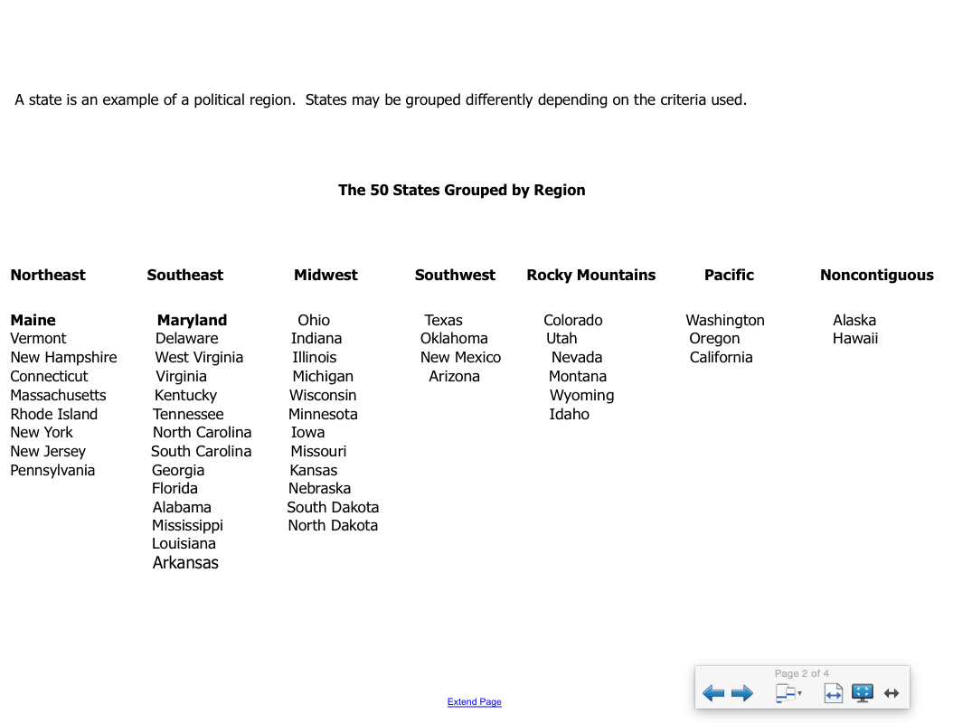
After talking with the students about the regions and talking about anything they may already know about those regions, I have a simple list of the regions and the states included. With this slide I can ask students if they are surprised by what region any particular state is in. I also can go back to what students said on the first slide and talk about that.
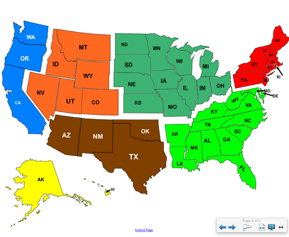
After we talk about that I have the region map once again but this time with the states included. In this slide the states are abbreviated rather than fully written out. This could be a good opportunity to teach children about how we abbreviate states names and help them to start to learn some of the states abbreviations.
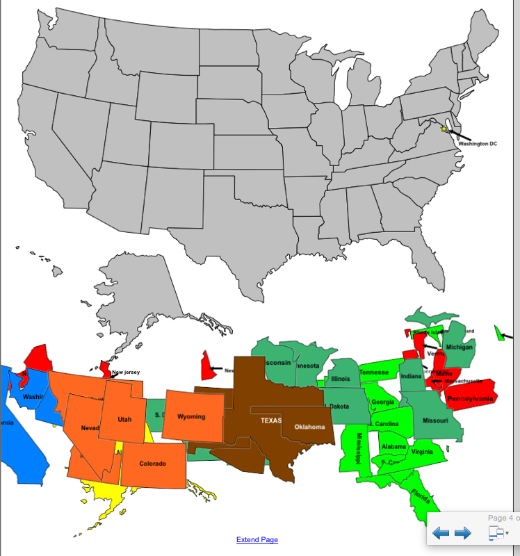
The final slide is interactive. The children can come up one at a time and slide the states to where they belong. This activity is good when we are first starting to teach the children about the geography of the United States. Its a fun way for students to learn where the states are rather than just starting at a worksheet or textbook and trying to memorize it.
 RSS Feed
